The next
day we returned to Pecos NHP to walk the Glorieta Battlefield trail before
taking the ranger guided battlefield tour.
For some
reason, I had this idea that the battlefield trail would be flat, why when Pecos is surrounded by mountains I
have absolutely no idea, but I did. So as
we were taking the tour in the afternoon we walked the 2½ mile trail much faster
than normal.
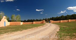
This is
at the top of a mesa and how the trail looks now,
but in March
1862 Union and Confederate troops would’ve had a very different view. Local farmers and ranchers would’ve felled
the trees for fuel or building and grown crops in the cleared fields. Soldiers on both sides would’ve had good
views and ditches and arroyos would’ve provided much needed cover for both
sides during the battle.
There is a
lot of information about the battle, which is also known as the Gettysburg of
the West, but trying to put it in a nutshell, the Confederates saw the Santa Fe
Trail
Part of
the original Santa Fe trail
as a way
to conquer the west, opening up a route to the pacific ports and the Colorado
goldfields. Union soldiers from
Colorado and New Mexico blocked their way.
Things
seemed to be going the way of the Confederates who had their headquarters at
Pigeons Ranch
however their
supply train was left near Johnsons Ranch the Confederate commander, thinking ‘there
was no way’
it could
be attacked left only a small party guarding it. What a mistake that was!
Union
soldiers marched from their camp near Kozlowski’s Trading Post,
climbed
Glorieta Mesa, attacked and destroyed the supply train, then marched back and
joined in the battle. That’s at least
12 miles, marching, climbing mesas, engaging the enemy and then returning to
fight a battle!
Part of
the battlefield is in private hands just of I25, it is open to the public,
there is no charge to visit, although donations are appreciated.
Ranger
Roger who led our tour was really enthusiastic and extremely knowledgeable on
the subject giving us masses of information.
Naming the Generals involved, although I must admit that sometimes I got
lost with the names and wasn’t sure which General was on which side! The fact that the battle took place in March
so it would’ve probably been cold and snowing, not something I thought about on
a nice sunny day.
Even now
discoveries are still made on the battlefield, not so long ago during house
renovations a mass grave was discovered and the remains removed for reburial.
Not far
from Pigeons Ranch there are memorial stones for the men who fell during the
battle.
We had a
fascinating day gaining an insight into one of the battles of the American
Civil War.
Have fun, we are!