Sunday 26 February 2017

Sonora Pass, Califoria

Exploring Sonora Pass had to wait for a couple of days as the first winter storm of the season blew in, snow fell and the road was closed.

Heading into Sonora Pass.

When the pass re-opened off we went.   Although it’s a lovely drive, I can quite see why it closes in bad weather and isn’t a recommended route for semi’s and tractor trailers.   In places it has a 26% grade and at its highest point the road over the pass reaches almost 10,000ft.   In places the snow poles were over twice my height! 

One of the amazing views as we drove higher into the mountains.

The road was narrow, with lots of bends as it rose steeply through the pass.   As we drove higher into the mountains streams were covered in ice and mountainside waterfalls were frozen, there was also quite a bit of snow on the mountain tops.


One of the many frozen waterfalls we saw.

We drove through stands of aspen shimmering in the sunshine and once over the pass through more aspen and past lots of closed campsites.   

At the Stanislaus Forest Geologic Site, Columns of the Giants we pulled in and crossed the Stanislaus river to join the short ½ mile paved trail.

The site reminded us of Devils Postpile, in that it was formed by volcanic eruptions and glaciers.   It was also a whole lot quieter.

After enjoying Columns of the Giants we turned around and headed back, stopping to now and again to read view point informational boards.

It was quite sobering to read about how, in 1852, the Clark-Skidmore party took 35 days to cross the Sierra’s, running dangerously low on provisions and in places being forced to raise and lower their wagons by hand around the peaks before being rescued. 

In 1841 the Bartleson-Bidwell party roamed the mountains for 19 days and after being forced to abandon their wagons, killed and ate their cattle.  Walking barefoot they were reduced to eating roasted acorns before they finally reached safety. 

The map below, from one of the informational boards, shows the route the Bartleson-Bidwell party took as they crossed the high Sierra’s.

As we climbed back into our nice, warm truck, I tried and failed to imagine those journeys I don’t think I’d’ve made a very good pioneer. 

The Pacific Crest Trail runs across the very top of Sonora Pass, at 9,628 ft.   We pulled in and I got out to take some photographs and walk my toes up the trail for a few hundred yards, just so I could truthfully say I’d walked some of the Pacific Crest Trail.   It was windy and absolutely freezing!   DB had much more sense and waited for me in the warmth of the truck.

Luckily for me it was downhill all the way back to our nice warm truck!

Although the modern road generally follows the original wagon route, in 1862 the trail was 1 mile further west travelling over St Mary’s Pass which is 10,040 ft high. 

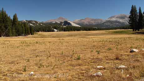
From a viewpoint as we drove back down Sonora Pass.

Mountains as far as the eye can see.

Almost back at highway 395 we drove past the Marine Training Centre.   We saw a MASH unit there as we drove by in the morning, but somehow I don’t think it was MASH 4077 Squadron!


Sonora Pass is an absolutely gorgeous drive, the more so because, for us, it was totally unexpected, and unlike Tioga Pass, it was also much quieter, of course in high summer it could be totally different. 

Have fun, we are!

Monitor Pass, California

After a lazy morning we decided we’d take a drive up highway 89 over Monitor Pass to Markleeville.

On Highway 395 a sign tells you whether or not the high Sierra passes of Tioga, Monitor and Sonora are open or closed.

Monitor Pass was open, so we followed the steep, winding road up through a canyon and high into the mountains, before dropping down on the other side.

We drove through lovely wide open meadows with beautiful stands of aspen glowing in the afternoon sunshine, before we arrived at Heenan Lake.


Heenan Lake is a pretty spot and is home to an endangered trout called the ‘lahonten’.   The bears in the area are big predators of the fish and as the bears come out of hiberbation in May, you might just see a bear standing in the creek catching the fish as they come to spawn.

Naturally the bears neither know nor care that the fish they’re happily munching on are on the endangered list. 

We spent so long at the lake that we never did make it to Markleeville, maybe next time.   On our way back there were some spectacular views.

Have fun, we are!

Saturday 25 February 2017

Virginia City, Nevada

Getting to Virginia City turned out to be fun as our sat nav suddenly decided to up and die.   We always have paper maps, but sat navs usually make driving through cities so much easier, driving through Carson City, I was really glad we had maps on our phone!
  
Our drive took us up the 15% grade road through Gold Hill.   Prospectors first came to Gold Hill in 1852 but it wasn’t settled until 1858.   In 1859 silver was discovered and it became a major community although never as big as Virginia City.   There was continuous competition between the two towns until mining declined in Gold Hill in the late 1880’s.
  
The Gold Hill Hotel and Saloon was once the oldest continually operated saloon in the area, until a couple of years ago you could get lunch there, but we were told it’s now closed.

Once in Virginia City, just past the Visitor Centre we turned into D Street and found somewhere to park.   It quite amused me when I read a plaque on the wall and discovered we’d parked in the old red light district!

The Visitor Centre was once the Crystal Bar, it has a tin ceiling and the original bar.   It’s worth knowing that buying your attraction tickets at the Visitor Centre usually gets you a discount.

Once the most important city between Denver and San Francisco, Virginia City was the home of the famous ‘Comstock Lode’.   At least $300 million of mineral deposits were pulled from the ground in a city where some men arrived as dirt poor prospectors and almost overnight became multi millionaires. 

The old, very uneven, boardwalks in Virginia City.

At one time Virginia City boasted an opera house, a school, churches and countless saloons, the wealth of the city also helped save the Union during the Civil War.

We took a trip on the Virginia & Truckee Railroad to Gold Hill and back.

One of the mines we saw from the train, I forget it’s name.

The famous Bucket of Blood Saloon, Apparently the name came about because when water used to clean the floors was thrown out there was so much blood in it that it looked as though they were throwing out ‘buckets of blood’.   Is it true?   I have absolutely no idea.

More views of Virginia City.


Wild mustangs roam freely through the city and as we drove out we were really lucky to see some.


We had a great time in Virginia City it has lots of history and many interesting buildings.   It’s well worth a visit, but while we enjoyed our trip we’re not big on casinos so we probably wouldn’t go  back. 

Have fun, we are!

A hike to Dog Lake

Our next trip took us along Tioga Pass Road and into Yosemite to hike to Dog Lake.   According to DB it was a short ‘easy’ hike, maybe a couple or three miles.

This time we arrived early and actually found a parking space, so far so good.   The start of the hike took us across open granite with views of Lembert Dome,

through a lovely meadow into the forest.

Once in the forest we soon hit the steep section, and climbed rapidly up 750 ft, it felt like more, in a series of steep switchbacks before sort of levelling out higher up.  

Dog lake is very pretty, but I have to say, not spectacular,   The clear, still, water reflected the blue sky, clouds, mountains, forest beautifully.

A most convenient log was a great spot to eat lunch and wonder how come a lake at an elevation of 9,240 ft in Yosemite got to be called Dog Lake.

Apparently it’s as simple as the fact that in 1898, Robert Marshall, a member of a US Geological Survey party, found an abandoned sheep dog with a litter of puppies by the lake.

You can walk around the lake, we thought about it, but storm clouds seemed to be building in the distance so even though we’d got rain gear with us, we decided against it.   Yes, I’ll quite happily admit, we are definitely fair weather hikers! 

We never actually saw a storm, but the clouds got very black as we drove back.


It was a fun hike but because of the starting elevation and subsequent steep switchbacks taking you rapidly up 750ft I wouldn’t exactly call it ‘easy’.

That turns out to be correct as the park service class it as ‘moderately strenuous’, so much for DB’s assurances that it was ‘easy’!

Still we enjoyed our hike, but I don’t think it’s one we’d bother to do again.

Have fun, we are!

Lake Tahoe, a cruise and a drive

We decided to take a cruise on Lake Tahoe and booked a trip on the MS Dixie II from Zephyr Cove.   Our drive to the lake took us over the mountains on the Kingsbury Grade, the views were fabulous but it’s definitely not a route we’d want to take if we were towing the fifth wheel!

Once over the mountain we joined highway 50 and it was about 3 miles to Zephyr Cove, after paying our $8.00 parking fee we headed for the dock.    As we’d bought our tickets in advance, we were able to bypass the ticket queue and board more or less straight away.

It was a gorgeous day, sunny and warm with cloudless blue skies, although as we sailed from the dock there was a chilly little breeze.

Our cruise took us across the lake and around the island in beautiful Emerald Bay and back across the lake.   Until we were out on the water I don’t think either of us realised just how big Lake Tahoe is. 

As we entered Emerald Bay.

After our cruise we’d planned to drive right round the lake, but when we got back to the dock we decided we’d leave that until the day after as we didn’t want to rush. 

Emerald Bay

So the next day we took the same route only this time we turned left instead of right, there were lots of casinos, until we crossed the state line into California. 

Mind you on the California side although there weren’t any casinos there were lots of houses in the forests surrounding the lake. 

As Emerald Bay looked so lovely, we decided we’d stop and spend some time on the beach, but first we’d stop at the overlook and take some photographs. 

Well, we didn’t get to do either.   The overlook parking was full, so I took photographs as we drove along.  

When we arrived at the Emerald Bay car park people were circling around looking for spaces, so that was out as well. 

Actually, not being able to park at Emerald Bay turned out to be a blessing in disguise, as further along we came to D L Bliss State Park.  

Here you can drive down through the forest to the beach, the road is steep and quite narrow in places.   As it was late September most of the camp sites were closed, in fact I think the whole park closed at the end of the month.   It was also very quiet, although I imagine that’s not the case during the summer.

The car park by the beach was empty when we arrived and we practically had the beach to ourselves.   We enjoyed our lunch, a couple of hours soaking up the sun and paddling in the lake, absolute bliss!

 After a couple of hours we reluctantly decided we’d better leave if we wanted to continue our drive all around the lake.   While we enjoyed the rest of our drive, from what we could see, the beach at DL Bliss State Park was the nicest. 

A view of the lake as we continued our tour around.

Just before we headed back over the Kingsbury Grade we stopped to pick up a few things from a Safeway on the Nevada side of the lake, it’s the only supermarket I’ve ever been in where you could play video poker while you were shopping!
 
Have fun, we are!

Tuesday 21 February 2017

Tioga Pass and into Yosemite

On our first visit to Yosemite we drove along Tioga Pass Road reaching Tenaya Lake, in the late afternoon.   With a winter storm forecast to drop a couple of feet of snow on the way, we decided to turn around.   Lucky we did, as the storm arrived, the snow fell and the next day the road was closed.

On this trip we drove in from Lee Vining on a gloriously sunny September day, with absolutely no storms on the horizon.

Tioga Pass road is the highest automobile road in California and reaches an elevation of 9,945ft.   It’s a fabulous drive and the views are simply spectacular. 

The view as we drove up Tioga Pass Road from Lee Vining.

In 1883 a 56 mile long wagon road from Crane Flat was built to reach a silver mine on the eastern slope of the Sierra at a cost $61,000.00.   The road finished just east of Tioga Pass.   The silver mine wasn’t profitable and closed the year after. 

Work started from Lee Vining on the east side of the Sierra in 1902, it was a narrow road with a 7% grade and a sheer drop into Lee Vining canyon.   The road was finished in 1910 and cost $63,000.00. 

The original wagon road from Crane Flat became a lightly used toll road and in 1915 Stephen Mather, the director of the National Park Service, bought it for $15,000.00 and donated it to Yosemite. 

Our view as we drove higher up the pass.

It was a dirt road until 1937 and must’ve been an exciting drive, but the maintenance costs were very high.   After an extensive survey, the road within Yosemite was rebuilt in 1961 at a cost of $7,000,00.00.  The Lee Vining Route from the east was rebuilt between 1965 and 1970 at a cost of $6,600,000.00.

The road is a California Historic Civil Engineering Landmark and is marked by a roadside plaque partway up the pass, and yes that is how I know all this. 

Once beyond the entrance, the park was really busy, all the parking spots along Tuolomene (pronounced ‘to-oll-o-me’) Meadows were taken and, at almost the end of  September, all the concessions were closed, so sadly, no chance of a coffee. 

We’d reached Tenaya Lake before we finally found somewhere to park, so goodness only knows what it’s like in high summer.   Surrounded by high granite (I think) domes, white sand beaches and crystal clear blue waters Tenaya really is beautiful but as it’s a glacial lake the water is absolutely freezing.

Eventually we decided we’d head back, this time there were more spots for us to pull in and admire the views, although it was too late in the day for us to think of hiking anywhere.

Tuolomene Meadows are really quite beautiful, although somehow I expected them to be much more open than they are.   I have no idea why I expected that, I just did.

On our way out of the park, we stopped and took photographs along the way, I’m not exactly sure where the one below is, but it’s looking towards the Ansel Adams Wilderness.

 
Dana Meadows.

 
Our view as we drove back down Tioga Pass Road.

Further down we came across a couple of large motorhomes, not something we expected to see along that particular stretch of road.

Have fun, we are!