Sunday 25 February 2018

Back to Bishop

From Tonopah we headed back to Bishop for a couple of days, we’d hoped that Tioga Pass, might be open but it was still closed due to snow, but we did return to Lake Sabrina now snow and ice free where we enjoyed coffee and hot apple cider.   I took away a piece of chocolate brownie which was truly scrumptious!

The road to the much higher South Lake was now open, so we drove up only to be greeted by our final wall of snow.

While we were there we met a chappie who was walking the whole length of the Pacific Crest Trail, starting in Mexico in April.   At the beginning of June he had made it to the Sierra Nevada where his progress had slowed because of the deep snow.   Instead of 25 miles a day he was now doing 15, we thought that 15 miles a day in deep snow was a pretty good speed.

We asked if it was safe to be up in the high Sierra’s on your own with all the snow he said it had been fine, but now the snow was starting to thaw it was unsafe so he’d come off the trail for a few days to stock up and was now going to meet up with some other hikers and they’d continue through the Sierra snowfields together.

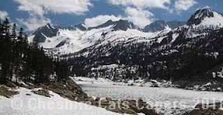
South Lake, still mostly frozen, in the clear mountain air you could hear the ice cracking.

We had a coffee stop at this beautiful meadow on our way back from South Lake.

Have fun, we are!

Gold Point, Nevada

Our last ghost town was called Gold Point.   We took the highway through Goldfield, making sure we slowed down as the Sherriff in Goldfield is hot on speeders, even the huge trucks slow down!   At Lida Junction we turned onto highway 266 before turning onto highway 744 for Gold Point.

Gold Point was originally established in 1868 when it was called Lime Point because of the lime deposits found in the area.   The name was changed to Hornsilver after high grade hornsilver (I have no idea what the difference, if any, is between silver and hornsilver) was discovered, changing back to Gold Point in the 1930’s when more gold than silver was being mined.

In 1942 as miners were drawn into essential war work for WWII major mining efforts stopped, so who knows there might still be a fortune in them there hills!

It looked as though new steel had been added onto this mineshaft, so we wondered if it was operational again.  

One of the original saloons, they always look so much bigger in the cowboy films!

As with almost all ghost towns most of the property is still privately owned.   We stopped outside Mitchells Mercantile and took some photographs where we met the owner a very nice lady who is a retired teacher from Las Vegas.  She opened the Mercantile for us to look inside, but doesn’t allow photography inside.

We got talking about Goldfield and I mentioned the hotel and the ghosts, she said there were ghosts in Gold Point and that sometimes she chatted to them.   I'm not sure whether or not I believe that, but years ago someone in Tombstone told me they did the same, so who knows.   

We loved this desert view.

Have fun, we are!

Change of plan & more ghost towns

Our plan had been to head to Caliente but we decided to return via Tonopah and Bishop.   Ely to Tonopah is a lovely drive but has to be one of the loneliest roads we’ve ever driven, it’s not far shy of 200 miles and once you leave Ely there is absolutely nothing.   We saw one gas pump that obviously belonged to a ranch, several ‘hamlet’ type places, a couple of abandoned towns, dirt roads heading in all directions off into the desert and that’s about it.

When we looked at the map we realized that for part of the way we were skirting the huge ‘secret’ military base called ‘Area 51’.   It was a good job it wasn’t night time as otherwise who knows what we might've seen!

On our return to Tonopah we stayed at the same RV Park and once more went ghost town hunting.

The semi-ghost town of Belmont was our first stop.   It’s quite a drive from Tonopah, or at least it seemed like it, we first took Highway 6 back towards Ely, branching off along highway 372 and then branching off along highway 82.   Lots of wide open spaces and very little else, in fact I don’t think we saw another vehicle all the way there.

Belmont was established in 1865 when Shoshone Indians first brought prospectors to the area, the name is from the French Beaumont meaning ‘beautiful mountain’ probably because of the view of Mount Jefferson from the town.

Quite a few people live in the town and, as almost always seems to happen we saw a UPS, truck they seem to turn up in the most unlikely places.   Silver, copper, iron, antimony and sulphur were all mined in Belmont and from 1865 to 1885 it’s estimated that ore to the value of about $15,000,000 was produced.    Imagine how much that would be today.

At one time Belmont was the county seat for Nye County and the town built a beautiful Italianate Courthouse.    Belmont was also the home of Tom Logan, the Sherriff who had an office in the courthouse and who died in mysterious circumstances outside a brothel in the nearby town of Manhattan.   We bought a very interesting book about him from Tonopah Mining Museum.

As the town fell into disrepair so did the courthouse and one of the stories we heard was that the drug addict and serial killer Charles Manson and his drug addicted followers squatted in the courthouse for a while and, supposedly, Charles Manson wrote his name on one of the courthouse door frames.   There are two different stories relating to their time in Belmont.

One is that at that time the only occupant of Belmont was an old lady who ignored them and they ignored her.

The other, my favourite, is that the old lady had a shotgun and ran them out of town.   I like to think of an old lady with a shotgun seeing off that murderous lot.

The courthouse has been partially restored and opens on selected weekends, needless to say we were there on a weekday.    

This building was once the office of the Belmont Courier newspaper.

What’s left of the Belmont bank.

The remains of the Combination Stamp Mill, there are lots of loose bricks at the top of the chimney; you really wouldn’t want to stand nearby in high winds!

As we left Belmont we stopped at the cemetery, for once we didn’t find the graves of any English miners.

Our next stop was Manhattan, another ghost town.   There is a shortcut across the mountains and the dirt road looked good, but as we kept running into snow this trip we took the long way round on the paved roads.   Most of Manhattan appears to be operational and it’s almost all marked private, so we just drove through, turned around and came back.   

Have fun, we are!

Hamilton, one of our favourite ghost towns

One of our favourite trips was out to the ghost town of Hamilton.

Hamilton was a silver boom town established in 1865, it was also the first county seat of White Pine County.   At one time there were about 10,000 people living in the town and there was a magnificent brick courthouse.   Sadly a couple of fires burnt most of the town and it never recovered especially when the price of silver dropped.

From Ely we followed highway 50 before turning off onto Green Spring road, a good dirt road.   We followed the road for about 11 miles as it wound higher and higher into the White Pine mountain range the views were fabulous.

We were wondering if we’d somehow missed the town when we saw a sign for the cemetery so we knew we were close by and yes there was still snow on the highest peaks of the mountains.

There are remains of brick, rock and wooden cabins and buildings all over the place, not to mention lots of rusty tin cans, broken glass and even bed springs!

Through the sage we could see more remains and dips in the ground but sometimes there are hidden uncapped mine shafts in there as well we didn’t event attempt to investigate.

We wondered if the mines were being re-opened as there was what looked like an almost new warehouse type building. Apparently back in the 70’s someone started mining in Hamilton again, but it wasn’t worthwhile so they stopped.   As we got closer we could see the place was deserted and that the doors and windows were broken, not to mention full of bullet holes!

Further along the road we parked and walked up to an abandoned chimney where we had panoramic views over Hamilton and the surrounding mountains.

We wondered if this was some sort of smelter as there was what looked to be coal lying about. 

Once again we found ourselves on the Old Lincoln Highway, the sign is on the right in the brush, we’re reasonably comfortable travelling these roads in our 4WD truck, but I’m not sure how much fun it would’ve been in a Model T Ford!

As we drove back to Ely we saw these wild mustangs grazing by the side of the road.


Even though it was Memorial Day Weekend when we visited Hamilton, we only saw two other trucks and one ATV we hadn’t expected it to be so quiet.

Have fun, we are!

McGill & Osceola

On our way back from driving the Success Loop we stopped in the small town of McGill and visited the Drugstore and Soda Fountain which is a National Historic Landmark.

When the owners retired they just closed the door and walked away leaving everything inside.   It’s a fascinating place and Dan, the volunteer on duty that day was full of information about almost everything in the store and the town.   Including that atomic tests had taken place in Nevada and that if your parents had been involved in the tests and you could find a prescription in the store then you were eligible for some sort of government payout. 

McGill Drugstore & Soda Fountain, Dan the volunteer at the soda fountain, which sadly is no longer operational.

Back on another dirt road we looked for the ghost town of Osceola in the Snake Mountain Range.   The ruins weren’t accessible as quite a few of the mines are operational again and they’re all marked private.  

We could easily see the new workings of one old mine.   A conversation with a passing trucker told us they were looking for Copper.

In Osceola Cemetery we found the gravestone of Charles Henry Odgers, born in Cornwall in January 1848 and died in Osceola in December 1903, that’s a long way from home.  

Have fun, we are!

Ely, Nevada - Lots to see & do around here

Ely is a lovely town with about 4,500 residents, it’s nice to visit but it’s a long way from anywhere and I don’t think either of us would actually like to live there.

We stayed at Ely KOA which is a very nice RV Park, with fabulous views across the valley to the mountains.   Inside the office there’s a list of distances to various locations and the last one says Walmart (back in Elko) 190 miles one way!


We visited the Ward Charcoal Ovens in the Ward Mining District, when the mines were operational over $1,000,000 worth of silver was produced.   There are six ovens; it took 6 acres of trees to fill one oven, so the trees were stripped from the mountains in no time.

After looking round the Northern Nevada Rail Road we took a ride on an old steam train where we heard about ghost towns and gold mines. 

Steam train ready to depart.

We drove to Great Basin National Park and Baker Archaeological Site through wide open country, we thought we’d been out in the middle of nowhere in other places, but Great Basin NP really is in the middle of nowhere.  The tiny town of Baker is so small it really isn’t really even a village.

Our plan had been to drive up Mount Wheeler and take a short walk to a couple of alpine lakes, but once again the road was still snowed in so that put paid to that, although we did drive up as far as we could.   I have to say when we got out of the truck it was absolutely freezing!

Even though we hadn’t booked in advance we’d hoped to be able to take a tour of Lehman Caves, but as we’d forgotten it was a holiday weekend all the cave tours were booked.   So, after a coffee in the Lehman Caves visitor centre cafe we drove over to the Baker Archaeological Site.

Sitting on the windswept plains at the base of the mountains, the site was once home to the Fremont People and there  really is absolutely nothing for miles.

Back in Ely we visited the White Pine County Museum; Northern Nevada is full of amazing museums.   One very interesting exhibit is about a prehistoric short faced bear, the remains of which were discovered nearby.

The bear stood about 12 - 14 ft high and had such incredibly strong teeth it crushed its victims to death.   However, it had one big disadvantage it had very thin leg bones for its weight, so while running in a straight line was no problem, if it swerved it could easily break a leg and become the hunted instead of the hunter.

The skeleton of the short faced bear, you really wouldn’t want to argue with that now would you?

Another day we drove high up into the Schell Creek Mountain Range along the 33 mile Success Loop Drive.   The drive takes you past numerous camp sites, through aspen groves and continues on until it reaches highway 93.    Where an informational sign told us that, once again we’d also been following the route of the old Lincoln Highway.

Higher up the mountains I caught this deer as it bounded into the aspens, but it was only afterwards I saw what someone had carved into the bark of one of the trees on the left of the deer!   

Have fun, we are!

Tuscarora and heading to Ely, still in Nevada

While we were staying in Elko, we took a drive out to Tuscarora, an almost ghost town, again lots more dirt roads.  On the way we drove through a partially repaired section of road that only a few days earlier had been washed out.   The water was still rushing off the fields and running down one side of the road, before running under a cattle grid and onto the fields opposite, I took this photograph on the way back.

Tuscarora Cemetery was the first thing we came to on our way into town, inside we found the graves of a couple from Oldham, Lancashire who’d come in search of gold.  

Although Tuscarora has a Post Office and is classed as a ghost town it isn’t really as quite a few people appear to live there.   

Leaving Elko on our way to Ely we drove past another Pony Express Station, Schelbourne Station, where there were informational boards and this sculpture among the sage.

We also discovered that we were also driving part of the old coast to coast Lincoln Highway, which stretched from Times Square in New York, to San Francisco in California.


Have fun, we are!

Lamoille Canyon & Ruby Valley

On the way to beautiful Lamoille Canyon we stopped at the Little Church at the Crossroads which, to us, looked like the quintessential American church complete with spire and white picket fence.
Shaped by ancient glaciers the scenery in Lamoille Canyon is lovely and as we followed the road higher into the canyon, in places waterfalls and streams full of snowmelt were rushing down the mountainside.

Tyre tracks continued through the snow, but as we had no idea how deep the snow was going to be further on we decided to turn around.

Leaving Lamoille Canyon we followed another road that took us through Harrison Pass and over the mountains at a much lower level.   The paved road turned to graded dirt as we climbed and from the top of the pass we had beautiful views over the Ruby Valley.

One of the dirt roads at the top of Harrison Pass heading deeper into the snow covered Ruby Mountains.

Our first view of the beautiful Ruby Valley from the top of Harrison Pass.

At the bottom of the pass we followed the dirt road towards the Ruby Valley National Wildlife Refuge.   We drove along a dyke out into the lake, that was just wide enough for the truck, but as we got further along we began to wonder if there would be somewhere wide enough for us to turn around at the end.   Not long after that we came to a slightly wider section, so we turned around while we could.   I’m sure we probably would’ve been fine, but really didn’t want to have to try and reverse back along the dyke.

Ruby Marsh is a beautiful place with expansive views across open water and marshland to the mountains beyond.  

The Bressman Cabin was built in 1880 by Jacob Bressman from Pennsylvania, his gravesite is located near the cabin.  

The road also follows part of one of the supposed ‘short cuts’ on the California Trail (this one actually added a couple of hundred miles to the journey) and much further along is the site of the Pony Express Station that now stands outside the museum in Elko and the remains of a Fort.   Unfortunately, it was a good 40 miles one way to reach them, sadly too far for us that particular day.

After visiting the refuge we retraced our steps and then followed the dirt road all the way through the valley and back to I80.   Believe me that is one long dirt road.

We drove past roads and trails heading into the mountains, past ranches and cowboys and at one point we hit rush hour as a couple of cows and their cows ambled across the road in front of us.

A little further along a cattle dog was snoozing in the sunshine in the middle of the road and as we stopped it just lifted its head and looked at us as if to say ‘you want me to move?’ before ambling off to the side of the road.

 This jeep/ATV trail takes you to Overland Lake high up in the snow covered Ruby Mountains,   we didn’t drive up there as it looked to be a much rougher road than we’re comfortable driving.

Have fun, we are!