Saturday 18 March 2017

Chloride, New Mexico

Caballo Lake was overcast and cloudy as we headed off for the almost ghost town of Chloride.   Once we exited the interstate we left the cloudy skies behind.  

We’ve visited Chloride before, it’s a lovely drive with endless skies and wide open views.

At Winston we followed the road further into the mountains before coming to halt in Chloride at the parking area by the store and museum.

Once a silver mining town with mostly tough, hard working, hard drinking miners, Chloride grew to have a population of about 3,000 people.  

The town had practically everything a person could need, saloons, stores, assay office, laundry, livery stables, hotel, blacksmiths, red light district, etc., etc.,  but no church!

Freight, mail and passengers came from Engle, about 50 miles away and ox powered freight wagons drove the trails to Magdalena, making at least one trip a year to St Louis to bring in heavy freight.

Even though Chloride survived the silver panic in 1893 the town gradually dwindled away and now it’s a quiet little village backing onto the Gila National Forest and the Black Range.

We saw these deer wandering down the street as we left.

While we were in Chloride we had gorgeous blue skies and sunshine,

but as we got closer to Caballo, the darker the skies became.


Have fun, we are!

Giant Desert Figures

Giant Desert Figures.    The intriuging sign points up a gravel road leading into the desert.   Each time we’ve driven past I’ve wanted to explore, each time we’ve had the fifthwheel on the back, so not a good idea.

The Big Marias Area of Critical Environmental Concern is home to numerous rock art sites and also to geoglyphs, known as the Blythe Intaglios. 

Heading into the Big Maria Mountains.

Undiscovered until the first planes flew over the area, the age and meaning of the geoglyphs is unknown, lots of theories, but no-one actually knows. 

Similar geoglyphs exist in England, Australia, Peru and Chile but the only known ones in the US are at Blythe. 

The geoglyphs or ‘intaglios’ are created by scraping away surface gravel to reveal lighter gravel and soil underneath. 

As they’re delicate and easily damaged they are fenced, this human figure is 102ft from head to toe and its arms are almost 65ft long.

We found the other human figure, which is the longest and least disturbed, it’s just over 105ft from head to toe and it’s arms are nearly 92ft wide.  

Yes, this one is upside down, it was the only way I could photograph it without facing directly into the sun.


There are more figures including an animal one, but by then it was getting late so we never did find it.   Maybe next time. 

Have fun, we are!

Return to Oatman, AZ

Oatman was founded in 1906 and by 1931 the mines around Oatman had produced over 1.8 millions ounces of gold, the boom was over by the mid 1930’s.
Classed as non-essential to the war effort the last few mines closed in 1942. 

It’s a few years since we last visited Oatman, after finding a parking spot on Old Route 66 we strolled into town.  

The burros were out in force.   In Oatman the burros rule and traffic waits for them.   They came to town with the first prospectors and were used both in and out of the mines.  

As the mines closed the burros were released into the hills and now their descendents roam the streets of Oatman looking for handouts from the tourists.   Feeding the baby burros can kill them, so they all have stickers on their foreheads.

Hollywood movie stars Carole Lombard and Clark Gable spent their Honeymoon in the Oatman Hotel.   These days it’s no longer a hotel, but does have a restaurant and museum.


Oatman’s always busy and the day we visited was no exception.   We had a fun time, enjoyed a scrumptious ice-cream along with some people and burro watching. 

Have fun, we are!

Sunday 12 March 2017

More paddling in the pacific!

Hoping to avoid the high winds forecast for later in the day, we left Bishop early, it sort of worked.   Luckily, with the exception of a couple of places, Tehachapi Pass being one, the wind was mostly behind us.

After an overnight stay in Bakersfield and with more high winds forecast, we set off for Paso Robles earlier than planned.   Unfortunately the winds caught us part way across and the skies were dark the closer we got to Paso Robles.  Luckily we were able to set up before the rain came, it felt just like being at home!

The rain cleared overnight, but high surf advisories were still in the forecast for the next couple of days.   On our drives across to the coast, we saw some spectacular waves.
  
As we walked along the piers at San Simeon and the next day at Cayucos, we could feel the pier shake as the waves broke beneath our feet. 

Breakers from the pier at San Simeon

and at the pier at Cayucos

From the pier at Cayucos, we watched the surfers.

We stopped each day at the elephant seal colony, this one seemed to be having sweet dreams.

Juveniles play fighting in the ocean.

On another trip to San Simeon we paddled along the beach

and then stopped at the San Sebastien store.   Hearst Ranch beef is used for the burgers which are delicious, but absolutely huge!   There’s also a tasting room for Hearst Ranch Wines.

Amazing skies

Point Piedra Lighthouse close to the elephant seal colony.

At Port San Louis, we walked out onto the pier and watched the harbour seals, these two seemed to having some sort of disagreement.

Afterwards we spent the afternoon on the beach enjoying the sunshine and paddling in the sea.   RV sites overlook the beach, I think they’re first come, first served.   All the sites were full and we saw several rigs hoping to find a spot at departure time, I don’t know if they were lucky or not.

We had a great time on our return trip to the Central Coast.

Have fun, we are!

Big Pine Canyon

It was cloudy and overcast when we left Bishop on our way to Big Pine Canyon.   11 miles long, Glacier Lodge Road follows Big Pine Creek as it winds steeply up the narrow, curvy road to about 8,000 ft.

Big Pine creek.

At the end of the road lies Glacier Lodge with cabins, campsites and parking for day hikers.   Trails lead to some of the highest peaks in the Sierras, including 14,242ft North Palisade which is the 4th highest mountain in California. There are glacial lakes, alpine meadows, waterfalls, cliffs, granite outcrops and also the southernmost glaciers in the US. 

One of the ponds at Glacier Lodge.

The impassible summits of the Inconsolable Range, mean you can’t hike over to Kings Canyon or Yosemite from Big Pine Canyon, mind you that definitely wasn’t in our plans. 

In the Glacier Lodge store I discovered that here was another place that was closing for the season the next day.   The lady in the store told me that winters in the canyon are bitterly cold although the snow isn’t as deep as it used to be.

We followed the South Fork Trail for a short distance as it followed the creek.   Partway along the trail we interrupted a squirrel nibbling on a pine cone, it scurried away before before stopping to carry on nibbling.   Evidently it wasn’t going to let us interrupt its snack.

Aspens surround the creek as it rushes under the bridge, it’s very pretty, just after that the trail divides, climbing up to the North Fork and on to the glacier or continuing into the South Fork.


We carried on into South Fork a little way where we got a great view of one of the glaciers.    We think it’s part of Middle Palisade Glacier.

After mooching around for a while we started back down the canyon, stopping by the creek on the way.   As we looked around some deer darted out of the bushes before heading up the mountain.


It’d be nice to go back and hike further into the mountains, maybe one day.
 
Have fun, we are!

Cool, clear, soda water?

Another beautiful drive along Tioga Pass Road took us into Yosemite for our last hike in the mountains.   

As we were quite early we were able to find a parking space at the Dog Lake/Lembert Dome parking area.   And, even better, as we set off for Soda Springs, we had the trail to ourselves.


Soda Springs isn’t far and it really is an easy trail, if there is an elevation gain it’s so little you don’t even notice it.   The trail follows the Tuolumne River with amazing views all around.


Unlike all the other springs we’ve ever visited, at soda springs cold, naturally carbonated water bubbles to the surface and has done so for thousands of years.   Why is a total mystery, even to geologists. 

There are several small springs, but the main spring is enclosed by a protective wooden surround.


As it comes out of the ground, the water is pure and uncontaminated, but there is always the possibility that it could be contaminated by animals or people.

Near the springs we stopped to look at the McCauley Cabin and Parsons Memorial Lodge.  

In 1897 the McCauley brothers bought the land for pasture from Jean Baptiste Lembert and built a cabin.   When it came up for sale again in 1912 it was bought by the Sierra Club to keep it uncommercialised.   They opened a small summer campground, in 1973 the National Park Service bought the land from the Sierra Club.


The cabin has a fabulous view.


Edward Taylor Parsons was a guide for the early Sierra Club and led hundreds of people into the high mountains.   He also campaigned with John Muir, unsuccessfully, to keep Yosemite’s Hetch Hetchy Valley undammned.   Edward Taylor Parsons died in 1914.


In 1915 The Sierra Club erected the lodge in his memory as a meeting place and reading room.   Parsons Lodge is used as a centre for exhibits and special programmes as well as a refuge from afternoon thunderstorms.   It is now a National Historic Landmark. 

A couple more of the beautiful views along Soda Springs Trail.


We had a fabulous day and really enjoyed our last hike in Yosemite and who knows, maybe one day we’ll get to come back again. 

Have fun, we are!

Tuesday 7 March 2017

River Springs Stage Coach Station

It was a little breezy but otherwise a warm, sunny day as we followed highway 120 heading west out of Benton Hot Springs until we reached the dirt road to Pizona Springs.

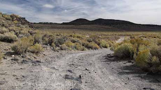
Leaving the paved highway behind us, we set off to find River Springs Stage Coach Station following the seemingly endless dirt road. 

Somewhere back there is highway 120.

At about 5 miles in, on a small rise hard against a hill, we came across a ruined building.   Found it!

The porch and some wall sections have long since fallen down, surprisingly there are still quite a few shingles on the roof.

Inside we could see the remains of walls, floors and a huge rock fireplace.  


Outside lying around among the rocks and bushes we found the rusted remains of tin cans, bits of coloured glass and even something that looked like an old stove pipe.

Apart from the wind, the only other sound we could hear was the burbling of the springs.    Now classed as an environmentally sensitive area the springs are partly fenced.

On the otherside of the rise, are the remains of hitching posts and corrals, although one corral and a chute look as though they could still be in use.

It’s an atmospheric place, and I really wouldn’t’ve been surprised to hear hooves pounding, wheels rumbling and harnesses jangling as a stagecoach swept around the corner.

Three dirt roads converge at River Springs, two of which are marked as jeep/ATV roads. 

There is a jeep/ATV road is on the right of the cattle chute.

One has no markings and we assumed that's the one marked on the map as leading to Antelope Lakes and back to highway 120. 

We thought of returning this way and probably it would’ve been fine, but one thing we’ve learnt over the years is that even though our truck is high clearance and 4WD, we’re usually on our own, so sometimes it’s best to err on the side of caution.

The only reason we found River Springs was because of a free map we picked up from the BLM information board at the start of the Petroglyph Trail.   It just goes to show that sometimes acidental finds can be some of the most interesting.


Historic River Springs stagecoach Station in Adobe Valley definitely turned out to be one.
  
Have fun, we are!