Monday, 10 February 2014

In search of pie

Our next stop was Grants, New Mexico, the plan, was to visit Chaco Canyon NHP, needless to say the weather didn’t co-operate, it turned cloudy and a lot cooler.   A couple of people also staying on our campground tried to get there and had to turn back because of rain and washed out roads.   So once, again our plans to return to Chaco were abandoned, one day!
 
Instead we decided we’d head over to Pie Town and try some of the famous pie.  I always thought we were nearer to Pie Town when we stayed at Kiva RV Park, in Bernardo but DB said he thought we were closer in Grants (more of that later).
 
It was a cloudy, chilly day and as our route took us along NM177 to Quemado we filled up with diesel and coffee before we headed off.   It’s a long, lonely two lane road that takes you through El Malpais, past the Sandstone Bluffs and La Ventana, a beautiful natural arch, along The Narrows where the lava flow almost seems to lap like waves against the sandstone cliffs and then out across the wide open plains.
 
We stopped, briefly, in Quemado, it was so cold we took our photographs of the church out of the truck!  

We turned for Pie Town, getting quite excited at the few glimpses of sun through the clouds, thinking it was going to warm up, needless to say it didn’t, but then again we were at 8,000 ft.

Due to its strategic location travellers have always stopped at Pie Town for rest and refreshment, the pies made by the first merchant in town became famous because of their quality.   Locals and travellers alike started to refer to the town as Pie Town and the name stuck. 

We stopped at the Pie-O-Neer Café,

The counter inside the café.

So which one should we choose?

After much deliberation Mike had peach pie and I had New Mexico apple with green chile, pine nuts and huge dollop of ice-cream both were very nice.

There is also a windmill museum in Pie Town, but it was so cold and windy that we literally ate our pie, drank our coffee and left.

This is when we discovered it was going to be a much longer drive back to Grants than we’d planned.   Our return route short cut was along what turned out to be dirt roads, probably because of all the recent rains they’d become rough and washboardy, we thought if we carry on, the road might get better, wrong!

After a few miles of being bounced around, DB said he’d had enough, and I must admit so I had I, not to mention the fact that it was probably going to take us much longer to drive back that way than we’d thought.   So we bounced our way back, (we really are fair weather dirt road travellers!) to the main road and returned the same way we’d come along nice smooth paved roads.
 
While we enjoyed our trip to Pie Town, I have to admit, had we realized quite how far it was from Grants we probably wouldn’t’ve gone.
 
Have fun, we are!

Monday, 20 January 2014

Exploring NM 63 high up into the Pecos Valley

We decided we’d explore more of the Pecos Valley by following NM 63 to its end high up in the mountains, at Cowels, well that was the plan.
 
Driving into Pecos, we turned left and followed the road as it wound its way up the canyon, it’s a very picturesque drive.
 
On the map I’d seen a sign for an area with the intriguing name of ‘Holy Ghost’, but when we reached the turning the road was closed.   

We stopped to have a look at the old bridge crossing the river


After exploring for a while, we crossed the new bridge and arrived at Tererro, we didn’t go any further as it looked as though from there it was a rough dirt road, so as we didn’t know the road conditions further up we turned back.

On the way back we stopped at the lovely old church of Nuestra Señora de Guadalupe in San Antonio-El Macho.   The existing church was built by Spanish American colonists in 1858, replacing the church originally built in 1830.   It was restored in the 1950’s after a back wall collapsed.

During the restoration 35 wooden coffins were found under the church floor and reburied in a common grave.    Before 1900 people were buried either ‘en la capilla’ or ‘en la iglesia’, the first recorded burial is in 1904 although there must’ve been burials before that.  There is an old cemetery on the hill above the churchyard, but in the church records there is no distinction between churchyard and cemetery.

The church is only 16’ x 26’ it has nine rows of pews on each side of the aisle with room for 4 people in each pew.

We really enjoyed our trip up the Pecos Valley, but what we hadn’t realized was that because of the devastation caused by the Tres Lagunas Fire earlier in the year and the danger of mud slides in the burnt areas caused by the torrential rains, the whole area had been closed until the end of August and almost all of the campgrounds and day use areas were still closed.

Have fun, we are!

Villanueva State Park, New Mexico

 
After reading about Villanueva State Park and how nice it was, we headed east on I25 exiting on NM3 and then followed the narrow two lane road into what was once Old Mexico.
 
Our first stop was at the church in San Miguel del Vado.   The Spanish Government approved the San Miguel del Vado Land Grant in 1794, settlements, including San Miguel were established along the Pecos River.   Once a port of entry, travellers and caravans entering from New Mexico paid customs and taxes to the Mexican government, customs activity continued until the area became part of the United States in 1846.

Once through San Miguel, the road follows the river most of the way, the verges were covered with wildflowers and bright green fields ran down to the river, it was very pretty.   In places we could see where sand and mud had washed over the road before being bulldozed away.    When we came to the sign for Villanueva State Park we turned left. 

The long narrow park is right on the banks of the Pecos River, with sites along the river and higher up the side of the valley.   This is a very historical area Conquistadores, including Coronado in 1540 came this way, followed by Francisco Sanchez Chamuscado, Fra Augustin Hernando and Rodriguez Gallegos in 1581, and Antonio De Espejo and Castaño De Sosa in 1592-1593.

Unfortunately for us the day we visited the visitor centre was closed, but a friendly ranger gave us a park map.  In view of all the recent floods in the area we asked if the park had been flooded, he told us that although the river had been very high and they’d been on evacuation standby they hadn’t needed to.  In fact he told us that at this time of the year (September) the river wasn’t usually this high.
 
Map in hand, although as this was the only trail across the river and we couldn’t get lost, (yes, we’ve heard that before as well!) we crossed the river and turned right to follow the trail to the top of the mesa. 

The trail climbs steadily up, passing a ruin on the way up.   From what the Ranger said it’s not known whether the ruin is Indian or Spanish, maybe it was Indian and then used by the Spanish, it’s a good spot for a lookout so maybe that’s what it was used for, but who knows.

We followed the trail right to the top and lookout, the views were tremendous and you could see for miles, in fact far in the distance we thought we could see the Wagon Mound but as we forgot to take a bearing we couldn’t really be sure. 

It was quite windy at the top and we needed to hang on to our hats, we tried calling Mum, but the call floated in and out with the wind so after a brief chat we gave up. 

This is the view of the campsite and river from the top of the mesa.
 
After enjoying the view for a while we followed the trail across the top of the mesa,

Before heading back down to the river, this section of the trail is steeper and rougher I was really glad we’d started off the other way. 

Once at the bottom the trail followed a ledge just above the river back to the bridge. 

Back at the truck we explored the rest of the park and then headed back, it’s a great little park and we really enjoyed our visit. 

Have fun, we are!

Tuesday, 24 December 2013

Merry Christmas


Have a magical Christmas
 
 and
 
 truly wonderful New Year

Sunday, 10 November 2013

Fort Union National Monument, New Mexico

Snow covered the top of the Sangre De Christos mountains on a sunny but very chilly day as we drove north on I25 to Fort Union, once the largest military post in the southwest.
 
On the edge of the plains the fort was established to protect surrounding settlements and travelers on the Santa Fe Trail from Comanche, Kiowa and Apache.

The view across the plains from the road leading to Fort Union.

Fort Union from the same spot.

The fort was the main supply depot for other New Mexico forts, anything and everything you could think of was purchased or traded at the fort which was probably the Walmart of its day!

Wagon ruts from the Santa Fe Trail cover the plains around the fort and in places the ruts form deep ditches.   I don’t know why but I always imagined the wagons went in single file, in places there were so many ruts it looked like an interchange on I40!
 
If you look closely you can see a depression in the ground, this is part of the Santa Fe Trail.
The fort that stands today is the third fort, two other forts were built, the first was built in a star shape the second was so close to the bluffs that it was within easy reach of enemy canons.
 
Officers Quarters

A cool wind blew across the plains the day we visited, whistling around the remains of the fort, we were told that the wind drove some people mad.   I loved the wide open views, but DB said it’d get to him after a while.
 
The wide open plains from the edge of the fort.

Rangers and preservators were busy working on the adobe walls on one section of the fort on another section they were working on the foundations of one of the buildings.

The fort covers a large area
 
and was home to many different types of building, Sutlers Stores, Stables, laundry, Officers and Mens Quarters, Laundry and even a jail.  
 
The jail and remains of the laundry
 
A huge hospital lay a short distance away and was used by both those at the fort and the local population.
 
After weeks of travel along the Santa Fe Trail, crossing mountains, rivers, plains, canyons, in all types of weather arriving at the fort must’ve been a huge relief.
 
We had no idea there was so much history in this area and we only covered a fraction of what there is to see, I think we'll have to come back!

Have fun, we are!

Friday, 11 October 2013

Ranches and Movie Stars

Our last ranger guided tour at Pecos NHP was with Ranger Patricia to Forked Lightening Ranch.
 
Our tour started at Kozlowski’s Trading Post, the last  major stop on the Santa Fe trail before arriving in Santa Fe itself.
 
Travellers arriving here after days of jolting along the trail must’ve felt like they’d died and gone to heaven as the trading post boasted comfy feather beds. Mrs Kozlowski was likely to feed you a dinner of fresh trout from the Pecos river about a ½ mile away as well as her famous piñon pudding filled with a liqueur and brought flaming to the table. 

Across the road from the trading post the ground is filled with the remains of wagon ruts from the famous trail.   I don’t know why but I always thought that the Santa Fe trail would just be a line of single wagon ruts, but in actual fact there are ruts everywhere and it was probably like I25.   Once the Aitchison, Topeka and Santa Fe railroad arrived in Santa Fe the trail was practically abandoned overnight. 

The trading post was part of the Forked Lightening Ranch which was home to Greer Garson and Buddy Fogelson. 

The ranch entrance

Forked Lightening ranch was originally built by Tex Austin the father of modern day rodeo, he took his rodeos all over the world, including London, but he had no luck with money.   Buddy Fogelson an oil baron bought the ranch.   He saw Greer Garson in the film ‘Mrs Miniver’, asked Hollywood friends to introduce them and the rest, as they say is history. 

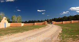
The deep salmon of the buildings and the blue of the window frames of the ranch were specially formulated to closely match the colours of the sandstone of the surrounding mesas and the deep blue of New Mexico skies. 

At the front of the ranch a deep portales (verandah) has amazing views over the confluence of the Pecos river and Glorieta creek.   Two flagpoles at the front of the house flew the British and American flags when Greer Garson lived here.

Our tour took us through the house, which is slowly being restored to look as it did when Greer Garson was in residence.    

One of the bedrooms.

All the rooms lead from one to another and all open onto a central courtyard.

It’s a beautiful house, just the sort of place you could imagine living in. 

Buddy Fogelson liked to hunt Greer Garson didn’t so they comprised by ‘skeet’ (clay pigeon) shooting.   The view from the range has amazing views across the ranch lands to the Rocky Mountains

and across to the ‘convento’ in the park.

On Greer Garson's death the ranch house and part of its lands were left to the Pecos NHP.

Have fun, we are!

The Battle of Glorieta Pass

The next day we returned to Pecos NHP to walk the Glorieta Battlefield trail before taking the ranger guided battlefield tour.
 
For some reason, I had this idea that the battlefield trail would be flat,   why when Pecos is surrounded by mountains I have absolutely no idea, but I did.  So as we were taking the tour in the afternoon we walked the 2½ mile trail much faster than normal.
 
This is at the top of a mesa and how the trail looks now,
 
but in March 1862 Union and Confederate troops would’ve had a very different view.   Local farmers and ranchers would’ve felled the trees for fuel or building and grown crops in the cleared fields.   Soldiers on both sides would’ve had good views and ditches and arroyos would’ve provided much needed cover for both sides during the battle.
 
There is a lot of information about the battle, which is also known as the Gettysburg of the West, but trying to put it in a nutshell, the Confederates saw the Santa Fe Trail
 
Part of the original Santa Fe trail

as a way to conquer the west, opening up a route to the pacific ports and the Colorado goldfields.   Union soldiers from Colorado and New Mexico blocked their way. 

Things seemed to be going the way of the Confederates who had their headquarters at Pigeons Ranch

however their supply train was left near Johnsons Ranch the Confederate commander, thinking ‘there was no way’
 
it could be attacked left only a small party guarding it.   What a mistake that was!
 
Union soldiers marched from their camp near Kozlowski’s Trading Post,
 
climbed Glorieta Mesa, attacked and destroyed the supply train, then marched back and joined in the battle.   That’s at least 12 miles, marching, climbing mesas, engaging the enemy and then returning to fight a battle! 

Part of the battlefield is in private hands just of I25, it is open to the public, there is no charge to visit, although donations are appreciated.   
 
Ranger Roger who led our tour was really enthusiastic and extremely knowledgeable on the subject giving us masses of information.   Naming the Generals involved, although I must admit that sometimes I got lost with the names and wasn’t sure which General was on which side!  The fact that the battle took place in March so it would’ve probably been cold and snowing, not something I thought about on a nice sunny day. 

Even now discoveries are still made on the battlefield, not so long ago during house renovations a mass grave was discovered and the remains removed for reburial. 

Not far from Pigeons Ranch there are memorial stones for the men who fell during the battle.

We had a fascinating day gaining an insight into one of the battles of the American Civil War. 

Have fun, we are!