Sunday, 19 October 2014

La Junta, Colorado

We stayed in La Junta for a few days and while we were there we visited a couple of interesting places.
 
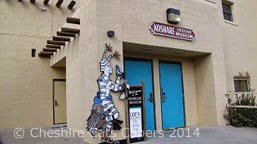
Koshare Indian Museum
 
In 1933 a group of boy scouts created an organisation to study Indian Culture, the lady in the museum told us that the word Koshare means clown.
 
Koshare Dancers are members of Boy Scout Troop 232 and Crew 230 of the Rocky Mountain Council, the dancers make their own outfits and interpret songs and dances of American Indians taught to them by Indian friends.

The dances take place in a specially built giant Kiva, it’s beautifully made and has the largest self-supporting roof of its kind in the USA it has over 600 logs and weighs nearly 40 tons.   Unfortunately there were no dances scheduled when we were in La Junta.   The dancers also take their show on the road.

Along with some of the dancer’s costumes the museum has some very interesting artefacts.  

Otero Museum 

The museum is very well done, on our visit two very helpful volunteers showed us around.   The museum show cases the history of the town and its inhabitants. 

There is a replica of La Junta’s 1876 log cabin school house,

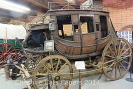
a stage coach

A replica of the inside an old ‘Mom and Pop’ store

La Junta has the oldest chartered volunteer fire department in Colorado and the museum has two vintage fire engines in its collection.

For a small town the museum is fabulous, we really enjoyed our visit.

Have fun, we are!

Boggsville Historic Site, Colorado

Boggsville Historic Site is about 16 miles east of Bent’s Old Fort, on our first attempt to find it we got lost, driving along quiet two lane roads past farms and fields before we realised we were halfway to Kansas!
 
On our second attempt we realised we’d gone left when we should’ve gone right, just goes to prove we should’ve read the directions properly!   Oh well we found it in the end.
 
There is a lot of history here, Zebulon Pike passed this way in 1806 as he followed a Spanish trail.   Traders from Taos held trade fairs near here in 1819, the same year that the treaty was signed that made the Arkansas River the boundary between the Spain and the USA. 

In 1825, a grizzly bear attacked a party of trappers; a few days later one trapper died of his injuries and was buried on the banks of the Purgatoire River.   Thank goodness there are no grizzly bears today! 

Travellers on the Santa Fe Trail passed through Boggsville, arriving through an avenue of trees, the avenue of trees is still there, but I don’t think either of us thought to take a photograph, this is the one on the information board.

Kit Carson and his wife Josefa lived and died here, their original grave site was marked, although they’re no longer buried here as they were moved but I can’t remember where to.  The adobe house they lived in, is no longer there as it was washed away in a flood some years ago.

In the Boggs house there are the plans of the old town and it was much larger than we expected.   The volunteer opened both the Boggs House


and the Prowers house for us, the Prowers house was originally much larger and had 3 wings.

Even though it looks like brick, it’s actually adobe and is painted to look like brick.  Farm fields behind the Prowers house were also once part of the settlement.

It’s an interesting site with a lot more history than we realised so we were glad we actually found it!

Have fun, we are!

Wednesday, 17 September 2014

Following the Santa Fe Trail

The Santa Fe Trail stretched from Kansas to Santa Fe and took 8 hard and tiring weeks to cross.   We’ve explored sections of it before, so as we were in La Junta we decided to explore the section that stretches along highway 350 from Trinidad.
 
Travellers forded the Arkansas River near modern day La Junta, from there they faced 16 long dry miles until they reached the permanent water source of Timpas Creek.
 
Looking towards Timpas Creek
 
As they followed the creek a bluff at Sierra Vista gave them their first glimpse of the edge of the plains and the southern Rocky Mountains.  

Raton Pass from the Santa Fe Trail. It’s hard to imagine that what took us a few hours to drive would take a wagon train at least 4 days.   The travellers must’ve thought they were never going to reach the mountains.

From there they travelled on to Iron Springs, which was an important watering hole for livestock.  The water was full of minerals and didn’t taste very nice.   I assume the spring is still out there somewhere, but we could only see mile upon mile of rolling grasslands.

Wagon ruts.

In 1861 the Missouri Stage Company built a stage station here, which was the only stop on the trail between Bent’s Fort and Trinidad until 1866. 

Juniper posts, low mounds of earth and scattered stones, along with well-preserved wheel ruts are all that’s left of the stage station and the Santa Fe Trail. 

The remains of the old stage station

I wonder what this once contained.

I loved the colour of the piece of glass and wondered if the wire was once part of a fence.
 
 One of the juniper posts at the stage station.

The remote wide-open grasslands are spectacularly beautiful, while we loved visiting and exploring, the difference between us and the pioneers was that we were travelling in a comfortable air conditioned truck, following a wagon train would be a whole different story. 

Have fun, we are!

Bent’s Fort, La Junta, Colorado

Originally called Fort William, Bent’s Fort was established by William and Charles Bent and their partner Ceran St Vrain in 1833 on the north bank of the Arkansas River.   At the time the river was the international boundary between the US and Mexico, Bent’s Fort operated as a Fort and trading post, fur trappers, the Cheyenne, Arapaho, Kiowa and other tribes all came to trade.
 
Traders at the fort exchanged, cloth, glass, hardware and tobacco for silver, furs, horses and mules.   Indians camped outside the gates on the prairie and exchanged buffalo hides and horses – no questions asked - for blankets, axes and firearms, although I imagine the traders were careful about who got the firearms.

The Trading Room. 

The fur press, centre below, was used to compress the fur into bales to make it easier for transportation. 

The fort must’ve been a welcome sight for travellers who’d been two months on the Santa Fe Trail, as it gave them an opportunity to repair wagons, stock up on supplies and rest before continuing their onward trek across the prairie and mountains. 

Generally different types of people mixed freely at the fort, but at meal times the upper classes and their guests ate in the dining room.   The cook was William Bent’s slave, Charlotte and she was famous for her pumpkin pies and flapjacks.  Everyone else either cooked their own meals or ate from the community pot, I’m not sure I’d want to know what exactly was in a community pot!
 
Dining Room

Storeroom

Susan Magoffin, who was 18 at the time, travelled the Santa Fe Trail with her husband on the way to trade in Mexico, she spent 18 days at the fort after she lost her baby and was delighted with her room, which she noted in her journal had two windows.   Mind you she wasn’t as delighted with the mosquitoes.

In 1846, because the Bent’s were effective peacemakers, the fort was used as the headquarters for the Upper Platte and Arkansas Indian Agency.   When the US went to war with Mexico the fort’s strategic location on an established road made it an ideal staging post for troops.   

Stretching furs.

Settlers and gold seekers disrupted the carefully nurtured Indian trade, faced with polluted water holes, decimated cottonwoods and declining bison tensions exacerbated between the Indians and whites, a cholera epidemic was the final nail in the trade coffin.   The fort was burnt, it’s thought by William Bent after he tried unsuccessfully to sell it to the US army. 

The billiard room and bar

The fort was reconstructed in, I think, the 1970’s by the park service with the aid of drawings done by Lt, James Abert in 1846 and from accounts by contemporary visitors and archaeological findings. 

Bent’s Old Fort is a living history site with the rangers dressed in period costume.   It gave you us real feel for what life might’ve been like back then and you know what, I think I prefer now!


Have fun, we are!
Tuesday, 26 August 2014

Kasha-Katuwe - Tent Rocks National Monument

Each time we’ve driven to Santa Fe, as we’ve sailed past the sign for Tent Rocks we've thought that looks like an interesting place to visit.   We finally made it, following I25 north we exited at 259 after that followed the signs on SR 22.
 
In the traditional Kersan language Kasha-Katuwe means “white cliffs”.   Over 6 million years ago, pumice, ash and tuff deposits over 1,000 ft deep fell as the Jemez volcanic field erupted.   Over eons wind and rain have created the spectacular hoodoos in the canyons and arroyos.
 
Francisco Vasquez de Coronado came this way as did Juan de Oñate, settlers followed and the land was claimed for Spain.   In 1680 the Cochiti people joined the Pueblo revolt and drove the Spanish back to Texas.   But by 1870 the railway arrived bringing with it, loggers, miners and others looking to enjoy New Mexico’s rich natural resources.
 
When we visited it was a great day for hiking day and we decided we’d do the Slot Canyon Trail first followed by the Cave Loop Trail.
 
For the first ½ mile both trails follow the same route as you enter the Slot Canyon, a sign warns you against entering if there’s any sign of bad weather.   Really good advice!
 
The trail is sandy, gravel type stuff and is quite wide to start with 

but it soon narrows as you reach the slot.   There is just enough room for one person, but luckily there are places where you can pause for others to pass. 

Unless the sun is directly above you it’s quite dark and cool in the slot as the walls rise high above.   In a couple of places I had to climb over rocks that had obviously fallen out of the canyon walls, creating intriguing holes. 

The final section of the trail climbs 634 feet more or less straight up steep gravelly switchbacks.   At the top I came face to face with a rock ledge, I’m not very tall so I really do mean face to face.   Luckily at the bottom of the ledge there was a pile of rocks to stand on. 

With a little help from DB I managed to scramble up, albeit on my knees and reach the top and the end of the trail.   From the end of the trail we could easily see over to Santa Fe and the Sangre de Christos Mountains, as well as the Jemez and Sandia Mountains.

The trail returns the same way, giving you different views of the spectacular hoodoos and I have to say climbing down the ledge was just as difficult as it was climbing up.

After coming out of the slot we followed the Cave Loop trail back to the car park.   This trail is totally different it’s much wider and leads past a man-made cave carved out of the soft rock.  The roof of the cave is black from ancient fires, archaeologists call this sort of cave a caveate.

We also took the 5 mile drive along BLM 1011 to the Veterans Memorial Scenic Overlook, sadly as we got out of the truck, the ranger arrived and told us we had 10 minutes and then he was driving back and would be locking the gate, so we didn’t get to do the 1 mile loop trail.   But again, even though it had got a little cloudy the views were fabulous.


Have fun, we are!

Along the Jemez Mountain Trail, National Scenic Byway - Part 2

A couple of days later we decided to carry on along the Jemez Mountain trail, this time as we left Bernalillo behind it was lovely sunny day.
 
This time our first stop was Jemez Falls, we had the place to ourselves.   The short ¼ mile trail to the falls winds under tall pines along an easy trail covered in large soft pine needles.   The needles reminded me of those used by the Apache to make baskets.
 
You can hear the falls and see the safety rail as you get closer to the end of the trail.   Here there is no actual ‘trail’ you just follow were countless people have walked over the years to get to the edge.   It’s very pretty and must be pretty spectacular during the monsoon season.

Valles Caldera National Preserve was our next stop, I didn’t think the preserve actually opened until the end of May, but highway 4 is a stunning drive that takes you across the wide open grasslands before continuing onto Los Alamos.   We didn’t expect the preserve to be open, but what we hadn’t realised was that the Preserve open at the weekend.   How lucky was that?   We turned onto the drive and followed the 2 mile dirt road to the visitor centre.  Traces of snow still lay on the ground at the side of the road and it was pretty chilly.

The caldera is a collapsed super volcano created 1.25 million years ago. Magma began to refill empty magma chambers causing lots of smaller eruptions which created rounded domes along a ring fracture.   At its highest point, Redondo Peak rose to over 11,000 ft making it one of the clearest examples of a ‘resurgent’ caldera.

While it’s generally considered dormant, about 5 miles beneath the surface is magma that some vulcanologists think could be ‘stirring’.   I hope they’re wrong as 5 miles doesn’t sound much between us and all that hot stuff! 

The area became public land in 2000 and encompasses nearly 90,000 acres of high elevation grasslands, forest, wetlands and shrub land.   It also contains the headwaters for the East Fork of the Jemez River and San Antonio Creek.

Sadly we arrived at the wrong time to take any of the tours, but this beautiful place is definitely on our ‘to return to’ list.

As we’d spent so long here, we didn’t make it to Los Alamos, instead we retraced our route and took a short, very short, hike along the East Fork of the Jemez River.   

Driving back into the tiny town of La Cueva we took the road to Fenton Lake State Park.   It’s very pretty and while we enjoyed our visit, I don’t think it’s somewhere we’d return to, as there is still a heck of a lot out there we’ve yet to discover.


Have fun, we are!

Monday, 25 August 2014

Along the Jemez Mountain Trail, National Scenic Byway

Sunshine and cloud fought for supremacy (it took a while, but sunshine eventually won) as we left Bernalillo behind in our rear view mirror.   When we reached San Ysidro we left the heavy traffic on four lane highway 550 behind as we turned onto highway 4, the quieter Jemez Mountain Trail.  

Our first stop was Jemez Pueblo, where we stopped at the Walatowa Visitor Centre.
   
The museum about the history and culture of the Jemez people was very interesting and informative.  

Leaving the pueblo and visitor centre we followed highway 4, until we came to highway 485 leading to the Gilman Tunnels.

The narrow road follows the Guadalupe River and is all that remains of a railway line constructed in the 1920’s to haul logs out of the forest.   The scenery was stunning and needless to say when we reached the tunnels I had to check the echo!

After the last tunnel the road turns to dirt and eventually arrives at Fenton Lake State Park.   We thought of driving that way, but as we weren’t sure of the condition of the road and none of the visitors we met at the tunnels had ever driven any further, we decided against it and headed back to highway 4. 

Driving this way turned out to be a very good idea as we had a lovely lunch, (hot chocolate to die for, deliciously tart Key Lime Pie, not to mention DB’s scrumptious raspberry tart) at the Highway 4 CafĂ© and Bakery in the small town of Jemez Springs.


The Jemez State Monument was our next stop.   The Monument contains the remains of the ancient pueblo of the Jemez people ‘Giusewa’


We almost had the place to ourselves as we followed the winding trail through the ruins.

Our next stop was Soda Dam, hot springs flowing into the Jemez river give off a distinct smell of sulphur and ‘rotten eggs’.   Over the centuries the water from the hot springs has formed a weird looking dam across the river.    It’s very pretty but quite slippery, so as it’s pretty darn hard if you fall we passed on that.
 
It was getting late in the day by the time we reached Battleship Rock picnic area.   A couple of hikes lead out through the forest one of which is about two miles long and leads to Macauley Warm Springs, one to remember if we ever come this way again in the future.

Although there was plenty more to see along the trail, we decided this would be our turn around point for the day and we headed back to Bernalillo.
 
Have fun, we are!