In view of
our last disastrous dirt road drive I’d hesitated to suggest exploring Box
Canyon on the Hassayampa River but the lady in the visitor centre assured us it
really was an easy drive. So on another
gorgeous sunny morning (whoever said you get fed up of constant sunshine hasn’t
got a clue what they’re talking about!) off we went.
After
heading north on highway 93 we turned right onto the scenic loop road just
after marker 195. Even though it’s
marked as a primitive road, it’s a good graded gravel/dirt road.
It follows
the river and at one point descends into a sandy wash unsurprisingly it’s
marked as a flash flood area, the views are spectacular.
We
followed the road for seven miles until we came to the ‘no dumping’ sign and
turned right into the parking area, if it wasn’t for the sign you’d easily
drive past. There was a fire ring and when we got out there was broken glass,
thankfully we hadn’t parked in it.
The
parking area
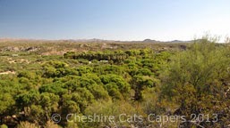
Looking
towards the river
The road
down to the river has plenty of tyre tracks, so you could probably drive down,
but it’s a bit rough so I don’t think for one minute DB would’ve been happy taking
BT down it, especially not after last time!
Down in
the river
A chap panning for gold in a small stream of
running water, told us there’s quite a lot of gold still to be found in the
area. We noticed some white plastic
pipes sticking up, these we were reliably informed by our gold panning friend,
were claim markers. Each claim is 20
acres and there is a marker in each corner
north, south, east and west.
The
entrance to Box Canyon is almost hidden in the trees, it’s only small but very
pretty, although it’s not somewhere I’d like to be if it was pouring with rain.
We
continued our hike, we were walking mostly in soft sand, it gives your legs a
really great workout but it’s hard work, we were looking for the ‘Majestic
Mine’ that we’d seen marked on the map.
The whole
area is pretty with lots of saguaro dotting the mountain sides, the rock
formations were interesting and I’m sure our geologist guide from Saturday
would’ve been able to tell us all sorts of interesting facts about what we were
seeing.
When we
arrived at where we thought the mine should be, we couldn’t see anything that
looked even remotely like it could be a mine.
Although searching the surrounding mountain sides there were some
suspiciously straight lines, and what looked to us, like spoil heaps, so we think it might be the mine and if it
is, the access must be from the top of the mountain.
We decided
we’d explore the river the other way towards The Narrows, lots of yellow
butterflies were fluttering around some water on the gravel.
Neither of
us had realised how hot it had become until we started walking in the shade,
which was lovely.
There was
more water in this section of the river and some government guys were busy
measuring things, although they didn’t actually say what they were doing we
wondered if it was something to do with water flow.
Further
along there was obviously what was someones camp on a ledge above the river,
I’m not sure I’d like to camp there as although it would be pleasant in the
heat of the day, it’d soon be dark down there and just a bit creepy, maybe it
belonged to someone working a nearby claim.
We passed
a gauging station, the ladder goes right to the top of the rocks, so I’m not
sure how deep it gets down here during the monsoon season.
A little
further along we arrived at the narrows,
it’s very
pretty, there’s more water here but it was too deep and to wide for us (okay
me) to cross without taking my boots off, so we turned back.
On the way back to the truck
Heading back
We had a great day, and would love to come back here and explore more, if you had an ATV you could probably drive all the way back to the RV park. That’d be fun!
Have fun, we are!


