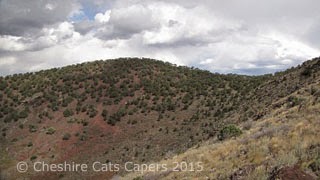
Highway 73 took us from
Raton, onto the wide open grasslands of windswept Johnson Mesa. At over 8,000 ft on a beautifully sunny,
clear, day we could see for miles.
Once we hit the top
of the mesa it was absolutely deserted,
all
we saw were some pronghorn, at least I think they were pronghorn, and in the
distance we could see some working cowboys.
We
stopped at the historic Johnson Mesa Church.
St John’s Methodist Episcopal Church was completed in the 1897 it’s on
the State of New Mexico Cultural Register.
The church was locked so we couldn’t look inside.
The cemetery is right
across the road. It’s a very lonely
place, and we wondered how far people have to travel to attend church?
Dropping down from the mesa
we drove into the tiny village of Folsom which, according to the sign, has a
population of 77. The village is named
after Francis Folsom, bride-to-be of President Grover Cleveland. When she stepped
from the train to explore the little town, the townsfolk were smitten by her
charms and changed the name from Rag Town to Folsom in her honour.
The main road in the
village of Folsom.
Folsom is probably
most well known as the home of the discovery of the Folsom Point. After a disastrous flood in 1908, a cowboy
called George McJunkin discovered a cache of fossilized bison bones and
realised that the bones weren’t those of modern bison. The spear points found in the skeletons
became known as the Folsom Points.
There is a small
museum in Folsom and I was looking forward to looking around it, but,
unfortunately for me it was only open by appointment. Oh
well, I suppose that is what you get when you’re travelling out of the main
season. Maybe we’ll get chance to visit
some other time.
Folsom Museum
Our next stop was the
Capulin Volcano National Monument. The
National Monument preserves a cinder cone that came into being about 60,000
years ago.
After watching the
informational film we drove the narrow 2 mile access road to the top.
There were some great
views across the plains, but we could see some black clouds approaching, although
they looked as though they’d miss us.
So we set off along the circular path around the cone.
It was interesting to
find out that what we thought were mountains were actually volcanic cinder
cones, shield volcanoes, tuff rings and volcanic domes and what looked like
flat topped mesas were actually ancient lava flows.
We could also see what
looked like rocky ridges, but were in actual fact pressure ridges. They are caused by hot lava flowing beneath
a surface that has already cooled and hardened, fascinating isn’t it?
As we followed the
path up the side of the cone, the storm we’d thought was quite far away was suddenly
closer, and we could hear the thunder and see the lightening. Oops! Hiking the highest point for miles around in
a thunderstorm isn’t the best place to be, so we abandoned our walk and headed
back to the truck.
The temperature
dropped and it was quite fascinating to watch the storm as it got ever closer.
Driving back down we
passed the ranger on his way to close the trail. Before we left the park it was pouring with
rain, and before we got to our planned lunch stop at Capulin Country store it
was snowing!
Sadly, the store no
longer has a restaurant, so lunch consisted of coffee and a chocolate bar. Mind you the store does have some really
rather nice things, but I resisted temptation and we followed highway 64 back
to Raton.
On the way the snow
turned to rain and we were treated to a spectacular lightening show.
Have fun, we are!


No comments:
Post a Comment